For centuries Esino was situated on one of the routes that linked the Lombardy plain and northern Italy with Europe, as testified by the ancient mule tracks present in the area. In the 19th century the construction of the military road that linked Lecco to Colico along the eastern shore of lake Como and the decline of Lecco’s iron industry placed the village on the edge of the main traffic flows, isolation mitigated by the tourism of the 19th century and in the new millennium by digital links.
The Museum documents the develop of the communication routes and the means of transport used in the past.
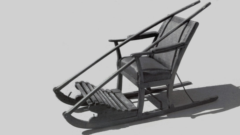
In the photo, a sledge used in the early 20th century to take tourists up to Esino (Associazione Amici del Museo delle Grigne Onlus / Wikimedia Commons)